Walks in the Trossachs and Loch Lomond are in abundance. Forest covered slopes, dramatic mountains and hills, waterfalls and miles of unspoilt countryside is what this area is renowned for The Highland Boundary Fault is the reason for all the hills and the landscape. It is a geological fault separating 2 physiographic regions: The Lowlands and Highlands of Scotland. 520 to 400 million years ago, the Highland Boundary Fault was formed as a result of a plate tectonic collision.
There are lots of downloadable booklets and maps available on the Maps and Trails page which you can print and use as guides before planning a route. Before you set off on your walk or cycle you should be aware of the Scottish Outdoor Access Code and ensure that you act responsibly and abide by the conditions in the code. You can download a summary of the code in this leaflet.
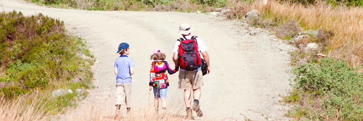
Long Distance Walks
The Loch Lomond and the Trossachs National Park has many walking paths including Long Distance Walks such as the West Highland Way which starts in Milngavie near Glasgow and passes through the National Park. After 151 km (96 miles) it finishes in Fort William in the Highlands.
The route passes beautiful scenery including lochs, glens, woodlands, moors and historical villages. Each year more than 70,000 walkers walk this route along the East side of Loch Lomond, past the foot of Ben Lomond, before going North to Crianlarich then out of the Park and onto Fort William. In average the route takes about 5 to 8 days depending how many miles you want to walk every day. A map of the route and pocket guide is available to download with lots of information about the walk and how to prepare for it. If you are planning the route use our Free Accommodation Finder to help you find suitable bed and breakfasts or bunkhouses along the way.
The Rob Roy Way is another long distance route and passes the Southern Highlands along beautiful countryside and historical villages. It starts from the village of Drymen and passes Aberfoyle, Callander, Strathyre, Killin and some other villages until it reaches Pitlochry after 92 miles (148 km). The route leads you through the Rob Roy Country which has lovely lochs, Glens and woodlands. The paths go along the Loch Ard Forest, Loch Venachar, Loch Lubnaig, Loch Earn and Loch Tay. If you enjoy hillwalking you can combine this route with walks to Ben Ledi or Ben Lawers which are on the Rob Roy Way. This walk leads you through the heart of the Trossachs. Every year the fundraising event ‘Rob Roy Challenge‘ takes place. It covers 55 miles of the Rob Roy Way.
Low Level Walks
In the Trossachs you can find some good short distance walking routes such as the Fairy Walk to Doon Hill and Reverend Kirk’s Graveyard in Aberfoyle. These walks are mainly on well defined forest tracks and trails and are waymarked. The maps have kindly been supplied by the Forestry Commission Scotland.
The Forestry Commission have also produced this leaflet which is available at The David Marshall Lodge in Aberfoyle or from the Tourist Information Centres around the National Park or click on the image to download a copy. The map has details of most of the walks above in one handy leaflet and also contains information on cycling routes, the Achray Forest Drive and lots of other useful information.
The National Park Authority has also produced a series of walking leaflets which cover the walks around various villages in the Trossachs and around Loch Lomond. A list of these leaflets are available to download on the Maps and Trails page and also copies can be obtained at the Visitor Information Centres.
Mountain Walks
For the more adventurous and those looking for a more demanding walk up one of the many mountains in the Trossachs area go to the Munros and Hills pages for more information on the most popular of the hills in the Park. We have included a sample of 3 strenuous mountain walks in the Heart of The Trossachs.
Glen Finglas
Starting on the Glen Finglas Road at Brig O’Turk with the village hall on the right and the Brig O’Turk Tea Room on your left, this walk climbs steeply winding its way through oak, birch & alder woodland with views over the reservoir & dam.
The terrain changes to open farmland leading to an open view of the Glen Finglas Estate. From here you follow the route to Balquhidder along a track meandering thru ancient trees above the Gleann nam Meann Burn to the head of the Glen, at its highest point you are 600m above Moine nan Each or “bog of the horse”, the views on a clear day are spectacular.
The track descends steeply into Glen Finglas with amazing views of Ben Ledi, the reservoir & glen; once part of an ancient medieval hunting forest. Continue over the pedestrian bridge over the Finglas Water and follow the burn side track which will eventually bring you back to Brig O’Turk.
Distance: 15 miles (24 km)
Type of Walk: Strenuous
Bus Stop: Brig O’Turk
Height Gain: 1650ft (500m)
Walking Time: 5-6 hours
Ben A’an
Starting from Tigh Mhor (an imposing ‘Castle Looking’ Stone Building overlooking Loch Achray) make your way west towards the woods that spread up the hill (opposite a small carpark).
The path up to Ben A’an starts here with no warm-up as you start with a climb, passing through Larch plantations and mixed woodlands all the while walking beside the (at times) fast flowing Allt Inneir Burn. The route is varied with a lot of scrambling up rocks, but persevere as the constantly changing views are worth the clambering.
The final assault is the most challenging, weaving at times through a constantly changing and rocky stream. A small chimney to the left offers an option to the top. Ben A’an must have one of the most rewarding views in terms of effort & time put in. Weather & time of day permitting you may be lucky enough to see the 100 year old SS Sir Walter Scott sailing up Loch Katrine and in the distance the distinctive 3 peak top of the Cobbler.
Distance: 3 miles (5.5 km)
Type of Walk: Strenuous
Bus Stop: Tigh Mhor
Height Gain: 2100ft (640m)
Walking Time: 2-3 hours
Ben Venue
From the main road walk into the Loch Achray Hotel grounds into the Queen Elizabeth Forest Park following the path along Achray Water. Bear left at the first fork following the track until it crosses, cross over the next junction and follow track when it forks to the right continuing through the forest. Once out of the forest you will head over open hillside, which turns uphill at the 1st of 2 cairns on the way to the summit.
On a clear day it is hard to beat Ben Venue summit for a view. Looking back you will still be able to see where you started from as well as The Cobbler and Ben Lomond to the west, Ben Lui, Ben Ledi, Ben Lawyers and Meall nan Tarmachan with Dumgoyne and the Campsies to the south. Lochs include Loch Arklet, Katrine Achray, and Loch Venacher.
If you have left your vehicle at the Loch Achray Hotel or are using the Demand Response Transport service you will have to return by the same route you came. However, it is possible to continue walking south to eventually come out at Ledard Farm at Kinlochard (5 miles on from the village of Aberfoyle).
Distance: 7.5 miles (12 km)
Type of Walk: Strenuous
Bus Stop: Achray Hotel
Height Gain: 2100ft (640m)
Walking Time: 5-6 hours
Downloadable Brochures
Go to the Maps and Trails page for a list of downloadable maps and brochures provided by the National Park and The Forestry Commission Scotland.
Remember the Code! Take only photographs and leave only footprints